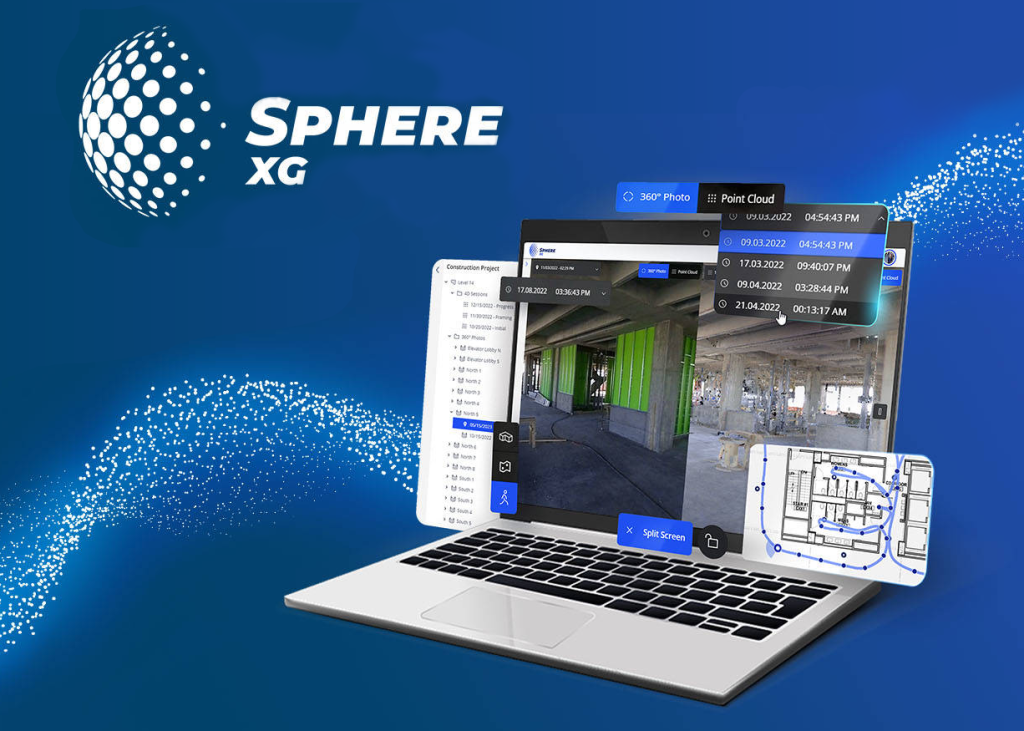
FARO Sphere XG is an advanced cloud-based digital platform designed for professionals seeking a centralized solution for managing reality capture and 3D models. With easy access through any web browser, it enables faster 3D data capture, processing, and sharing of 360° photos, greatly simplifying collaboration across teams anywhere in the world. Sphere XG brings all data together in one environment to ensure better project organization and faster decision-making.
A comprehensive platform for efficient 3D data and project management
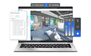
Sphere XG consolidates all your reality capture and 3D modeling data into a single platform, eliminating the need to switch between multiple applications. It allows you to upload, view, compare, and share 3D point clouds, 360° photos, and 3D models—all aligned with floor plans and tracked over time for powerful 4D construction progress management. This significantly reduces the risk of errors, discrepancies, or duplicated work as all stakeholders have access to unified, up-to-date data. Integration with the Stream mobile app enables pre-registration of scans directly on-site, speeding up completion times and reducing costs. Sphere XG not only streamlines organization and communication within projects but also opens new business opportunities by providing more efficient data management and improved quality control.
Bring together all your reality capture data and design data in a single platform, eliminating data silos. Sphere XG gives you access to 3D point clouds, 360° photos, and 3D models all in one place.
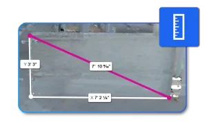
Accuracy
Easily and intuitively perform measurements within Sphere XG no expert skills required. Free up valuable time for your specialists to focus on more complex tasks.
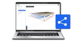
Accessibility
No need for powerful computers to view point clouds and 3D models. Simply share your project online, giving your team and stakeholders easy access anytime, anywhere.
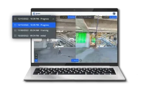
Progress Tracking Over Time
The TimeTravel feature lets you switch between different points in time within your 360° photos and point clouds to track progress. Upload multiple point clouds per sheet and compare reality capture data side-by-side.
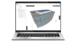
Data Alignment
Combine your design and point cloud data into one unified coordinate system. Just upload your 3D models in standard industry formats georeferenced models and point clouds will align automatically for accurate site inspection.
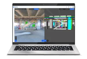
Find Discrepancies Early
Visually overlay point clouds and 3D models to compare actual site progress with your plan. Quickly identify potential clashes or deviations and address issues early before they escalate.


 EN
EN